Shop All Marine & Boat Speakers & Navigation
Garmin
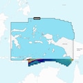
Navionics Vision+ NVAE024R, Central West Papua East Sulawesi, Marine Chart
Mfr # 010-C1222-00
Zoro # G308639374
product price: $187.99
/ea
Free Shipping & Returns
$187.99
Free Shipping on orders over $50
after you
Free 30-Day Returns
Product Information
- Brand Garmin
- MFR # 010-C1222-00
- Zoro # G308639374
- Country of Origin United States
- Category Marine & Boat Speakers & Navigation
Description
Navionics Vision+ NVAE024R - Central West Papua East Sulawesi - Marine Chart Get the world's No. 1 choice in the marine mapping with the best, most up-to-date Navionics+ cartography on your compatible chartplotter. Featuring vibrant colors, a streamlined interface and combined coastal/inland content with a popular Navionics style color palette, Garmin Navionics+ cartography makes it easy to plot your course. Multiple shading options aid in shallow water navigation and make it easy to highlight a target depth range for the best fishing spots. Fully customizable with various chart layers, overlay combinations and up to 10 color-shaded target depth ranges to scope out the best fishing spots. When you purchase a new Garmin Navionics+ or Garmin Navionics Vision+ cartography product, a one-year subscription is included. Chart Code - NVAE024R Coverage Area: Coastal coverage of Indonesia southeast and east of Sulawesi including East Timor and the ports of Surong, Manokwari, Manado, Makassar and Kendari. Features: All-in-one Map Solution - Access detail-rich mapping of coastal features, lakes, rivers and more. Integrated Garmin and Navionics content offers coverage for boaters worldwide. Daily Chart Updates - Charts are constantly being enhanced with new and amended content — as many as 5,000 updates are made every day. The one-year included subscription gives you access to daily chart updates via the ActiveCaptain app. Auto Guidance+ Technology - Combining the best of Garmin and Navionics automatic routing features, built-in Auto Guidance+ technology1 gives you a suggested dock-to-dock path to follow through channels, inlets, marina entrances and more. Depth Range Shading - High-resolution depth range shading lets you select up to 10 color-shaded options and view your designated target depths at a glance. Up to 1' Contours - For improved fishing and navigation, up to 1' contours provide a clear depiction of bottom structure for improved fishing charts and enhanced detail in swamps, canals, harbors, marinas and more. Shallow Water Shading - To give a clear picture of shallow waters to avoid, this feature allows for shading at a user-defined depth. ActiveCaptain Community - Community-sourced
Ratings & Reviews
3 Reasons You Can Count On Us

Supplies for every job.
10 million items and the exact one you need.

When you need it fast, count on Zoro!
2 million products ship in 1 day.

Stretch your budget further.
Everyday low prices on the brands you love.
Explore More Products
- JABSCO Quiet Flush Raw Water Toilet Compact Bowl 12V (37245-3092)
- TRUCK-LITE Super 44, Led, Clear Round, 6 Diode, Back-Up Light, Gray Flange Mount, Fit N Forget S.S., 12V (44344C)
- ZEROSTART Ul Tank, 1500W / 120V, Thermostat 60/80F (3309161)
- HUSKY TOWING TRAILER CONNECTOR, CONNECT 7WAY PLAS CAR END/CD/1 (30015)
- GARMIN Yamaha Engine Bus to J1939 Adapter Cable (010-12770-00)
- GARMIN GNX™ Wired Sail Pack 43 (010-01248-60)
- GARMIN NMEA 2000 Field Installable Connector, Female (010-11095-00)
- GARMIN 16" Protective Cover - Magnetic (010-12799-12)
- GARMIN Cable Coupler f/ Marine Network Cables w/ Small Connector (010-12531-00)
- GARMIN Garmin Split Connector Threaded f/RJ45 Network Cables - 18mm (010-11170-00)
- GARMIN Bail Mount w/Quick Release Cradle f/ECHOMAP Ultra 12" (010-12842-00)
- Garmin Marine & Boat Speakers & Navigation